Module 3: Classified Image of Forested Land In Washington State
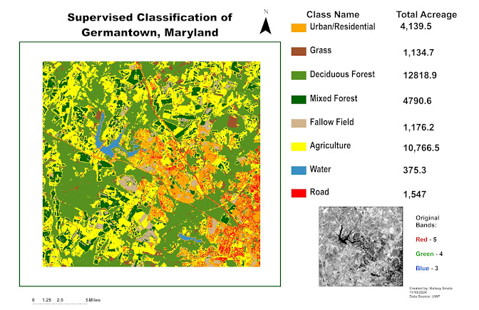
The map layout above provides a visualization of forested land in the state of Washington. This image has been classified into seven different categories: unclassified, NWVeg, SEVeg, Bare ground, Cloud, Water and Riparian. Provided is a legend and table with the total area for each classification, which was calculated in hectares. In this image, there were no areas classified as unclassified and therefore there is no area marked down. The classification with the largest area is the NWVeg with 25087.59 hectares. The classification with the smallest area is Cloud with only 205.29 hectares.


Comments
Post a Comment